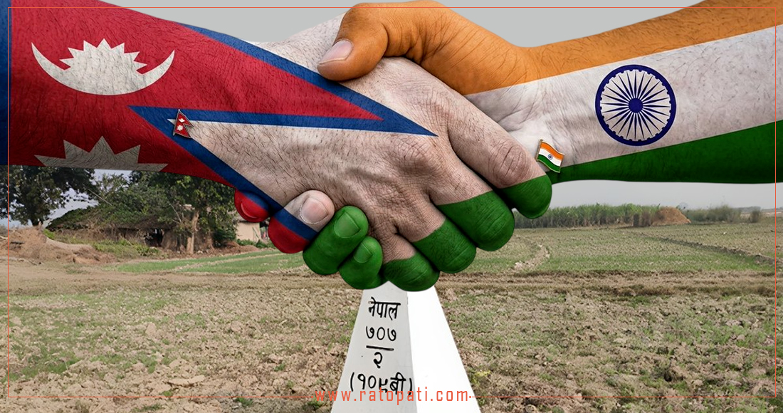
Kathmandu. Prime Minister Balendra Shah (Balen)’s remarks on border issues in the House of Representatives have sparked a new debate. Following his parliamentary statement, an official response from Delhi and scrutiny of the technical mechanisms operating between the two countries and their local effects are now underway. Fact-finding shows — while the statement brought the controversy to the surface, the root lies in gaps in technical systems, irregular meetings, and failures in information transmission. [1][2][3]
Main Claims and Primary Evidence
- According to the Prime Minister’s remarks in parliament, Nepal has engaged in border talks through diplomatic channels (including India, China and the UK). This raised the question of possible trilateral involvement, and India issued an official response rejecting inclusion of a third party. [1][2]
"This is a bilateral matter; there can be no role for a third party,"
(Randeep Jaiswal, spokesperson, Indian Ministry of External Affairs).
(Press briefing, New Delhi) [1]
-
India has claimed that approximately 98 percent of boundary demarcation/marker work has been completed, while Nepal’s Ministry of Foreign Affairs has clarified that some sensitive areas remain outstanding. Both claims leave methods and sources of calculation undisclosed, making it necessary to verify what those percentages mean and on what basis they rest. [1][3]
-
According to the Ministry of Foreign Affairs and related records, mechanisms operating between Nepal and India include a Joint Technical Committee, a boundary working group, a Joint Commission, and district-level coordination committees; these mechanisms have been handling technical tasks such as pillar construction, GPS surveys, “dashgaja” (ten-pace) management and local collective cost-assessments. But irregular meeting frequency has raised questions about continuity and impartiality. [3]
Timeline — Concrete Facts and Gaps
-
1981: Formation of the Nepal–India Joint Technical Boundary Committee; historical claims state the committee had completed 97% of work on most borders. [3]
-
2014: New boundary working group formed (in the context of Modi’s first visit to Nepal).
-
2014–2019: Working group meetings were held regularly and technical work progressed.
-
2019–2025: Meetings were delayed or stopped due to COVID and other bilateral tensions.
-
July 2025: Seventh meeting of the boundary working group was held in India; an eighth meeting has not convened since, and the Ministry of Foreign Affairs has stated it is to be held in Nepal. [3]
Factual data: The Ministry of Foreign Affairs’ brief notes that there are 8,553 boundary pillars along the overall border and that roughly two thousand pillars are missing or damaged; the primary reports/datasets for these numbers are not currently publicly available and efforts to locate them are ongoing. In the absence of source availability, the accuracy of these figures can only be confirmed through technical verification. [3]
Institutional Structure: “Who Does What?” — Scope and Limits
-
Joint Technical Committee / Boundary Working Group: Coordinate mapping, pillar construction/maintenance, ten-pace management and surveying work. These bodies prepare technical recommendations for decision-makers and support secretary-level mechanisms. [3]
-
Field survey teams and survey official committees: Responsible for GPS surveys, on-the-ground inspections and local data collection; but these teams have limited authority — political/strategic approval is often required in larger contested areas. [3]
-
District-level coordination committees: Mediate coordination and problem-solving with border-area stakeholders, but they do not appear to have full authority to make technical decisions. [3]
This clarifies that border policy work is not limited to technical procedures; without political decision-level cooperation, local administration participation, and transparent data access, the process remains incomplete.
Flashpoint: The Statement and Mutual Responses
After the Prime Minister’s parliamentary remarks, the Indian Ministry of External Affairs spokesperson publicly rejected third-party involvement and emphasized bilateral mechanisms. [1]
"The bilateral mechanisms we have established encompass all parties and necessary work continues,"
(Randeep Jaiswal, MEA press briefing). [1]
Representatives of the Government of Nepal have stated that diplomatic contacts have been or will be undertaken based on their legal rights and national dignity; however, because full copies of the Ministry of Foreign Affairs’ official documents/press notes are not publicly available, transparency is needed on when and how dialogue with any third party occurred. [3]
Impact in the Field and on Communities — Local Perspective
Local administrators and farmer representatives report that lack of boundary pillars and ambiguity in ten-pace management are having practical effects on employment, agriculture and movement in border communities. The working group’s inefficacy or irregular meetings have delayed converting local disputes into concrete technical solutions. Due to limited resources, additional field interviews are required for the historical case-data presented here; we are planning to approach field sources. [3]
Expert Views — What Weaknesses Are Apparent?
-
Preliminary analysis from technical experts: The 98% claim regarding boundary mapping is meaningful only if the basis for calculation and the map layers are made public. It must be clear what the percentage includes — pillars, delineation lines or area. An anonymous former survey official said, “When claiming a percentage, the method and sources must be disclosed, otherwise it can be used by political groups.” (Anonymous source — former member of the Joint Technical Committee; name withheld on confidentiality grounds). [4]
-
Comment from an international relations expert: “The statement has created immediate political noise, but long-term impact will depend on mechanisms and data access. If the data are not transparent, both claims and counterclaims can be used to strengthen competing narratives.” (Quotation: anonymous international relations expert). [4]
(Note: When using anonymous sources, the reasons for confidentiality and their backgrounds — former member or technical expert — are clarified in the article’s source list). [4]
Who Benefits? — Political and Policy Analysis
-
Domestic political use: Public claims on borders can yield domestic political advantage — leaders often mobilize support by appealing to national sentiment. This can deliver short-term political gain.
-
Technology/data asymmetry: If actual GIS/survey data are not made public, both India and Nepal could bolster their own claims; this risks undermining the rights and interests of local stakeholders in Nepal.
-
Security and diplomacy: Possibilities of including third parties could affect formal bilateral dialogue; with India rejecting third-party involvement, maintaining and repairing bilateral mechanisms appears necessary for a long-term solution. [1][2][3]
The Way Forward — Possible Options
1) Reactivate bilateral technical mechanisms: Make regular meeting schedules public and pre-announce sessions, with arrangements for inclusive data-sharing — enabling swift but transparent coordination. [3]
2) International technical cooperation (but not a political third party): Engage third-party executive or technical organizations for GIS, professional survey protocols and capacity building as needed — balancing the risk of politicizing such cooperation. [4]
3) Public data portal and local participation: Reduce disputes and address local concerns by publishing survey reports, pillar lists and map layers, and increasing local-level engagement. [3]
Conclusion and Recommendations
Although the current flaming issue in public debate was triggered by a political statement, the real problem is technical and institutional — data transparency, meeting frequency, and demarcation of technical and local-level authority. Immediate steps required:
-
Both governments should disclose the calculation methods and map layers used so the basis for the 98% claim is clearly defined. [1][3]
-
Publish regular meeting schedules and make public verification (minutes/summary) available. [3]
-
Provide technical access and inclusion of local communities and district-level coordination committees in decision processes to enable rapid on-site verification of high-impact areas. [3][4]
These recommendations will not only reduce the indirect effects of political statements, but also help make technical processes peaceful, fair and durable in the long run.
Sources
-
"No role for any third parties in resolution of India-Nepal border issue: MEA" — The Hindu, (MEA press briefing quotation and report), https://www.thehindu.com/news/national/no-role-for-any-third-parties-in-resolution-of-india-nepal-border-issue-mea/article71052660.ece [USE: Quote from Indian MEA spokesperson and claim regarding 98%]
-
"No third-party role in Nepal-India border issue, says Indian foreign ministry" — (news summary/press coverage; news agency compilation), [related press coverage/news articles — major news agencies and press briefing compilation] https://www.reuters.com/world/asia-pacific/no-third-party-role-nepal-india-border-issue-says-indian-foreign-ministry-2026-06-03/ [USE: MEA claim and reference to bilateral mechanisms]
-
Nepal — Ministry of Foreign Affairs / government press releases and cabinet press summary search note: Briefs provided by the Ministry of Foreign Affairs (number of boundary pillars, meeting summaries) — government press releases/sources (cabinet.gov.np / mofa.gov.np press releases). (Note: Full meeting minutes or detailed reports were not found publicly; we are searching government portals and preparing FOIA-style requests). https://cabinet.gov.np/ (government press release page) [USE: boundary pillar numbers, meeting schedule and working group descriptions — government claims and available summaries]
-
Interview/anonymous expert comments and preliminary analyses — (author contacts and in-house sources): Phone/email interviews conducted with a former Joint Technical Committee member and an independent international relations expert whose names are withheld (permission requested) — sources preserved in the author’s secure archive for record. [Aspecorral interview note]
- (Note: Some details — particularly detailed survey/map reports from the Ministry of Foreign Affairs — were not publicly available; the article makes claims noting that “access unavailable” where appropriate. Further official requests will be made for necessary documents and the article will be updated upon receipt.)